Highlighted
The field of unmanned aviation is relatively young and constantly evolving. New technologies and solutions are emerging all the time, and the number of activities where drones are becoming a useful assistant is growing as well. At OneDrone, we have been in close contact with all the trends since the early stages of drone development, and we are happy to share our knowledge with you.

Photogrammetry
Aerophotogrammetry is a method used to create 2D and 3D models from photographs with significant overlap. This technique is employed in various fields, ranging from geodesy, cartography, geology, to archaeology.
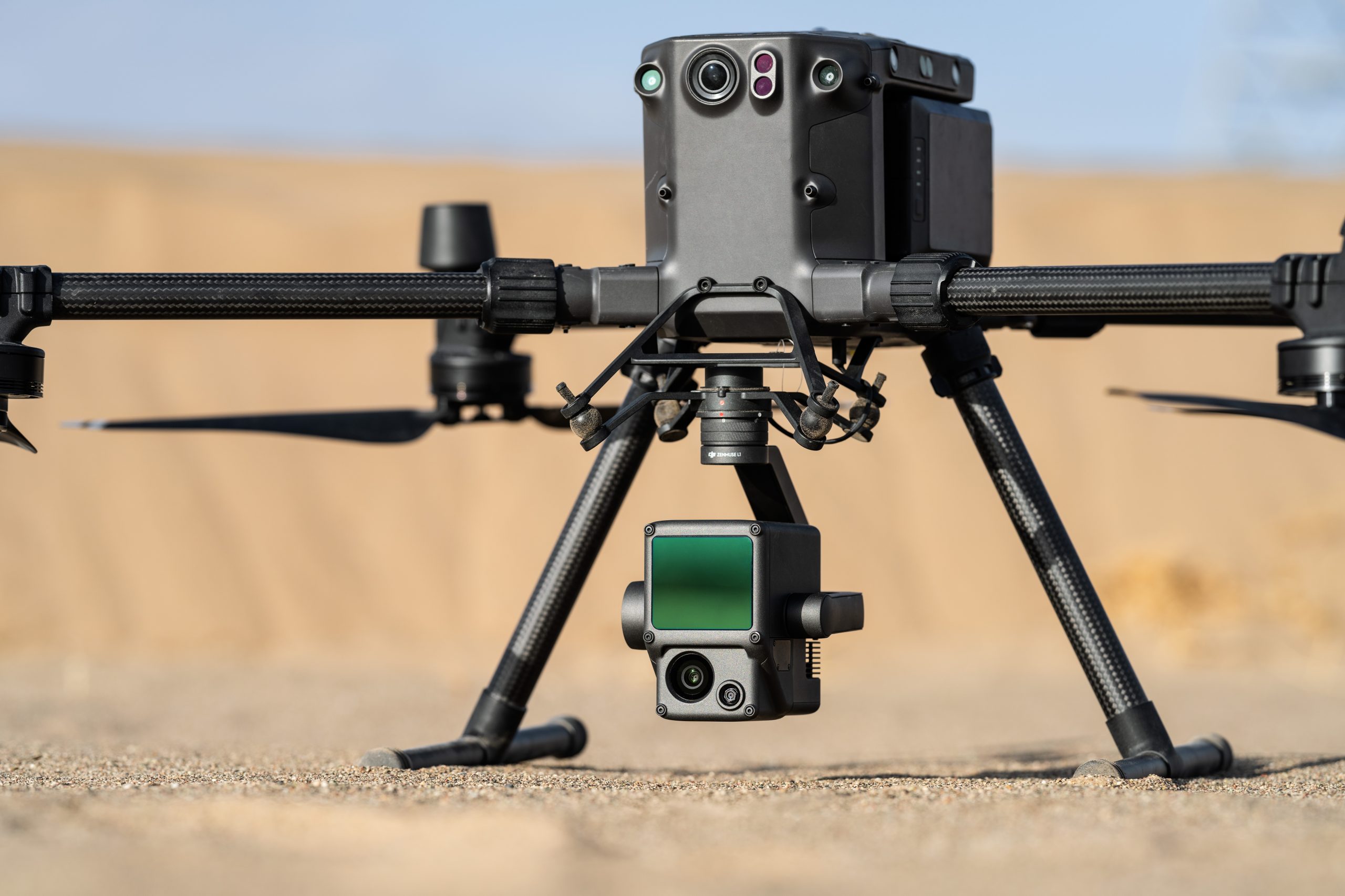
LiDAR
LiDAR, or Light Detection and Ranging, enables precise measurement using laser beams. We utilize this technology for creating accurate 3D terrain models in various fields.
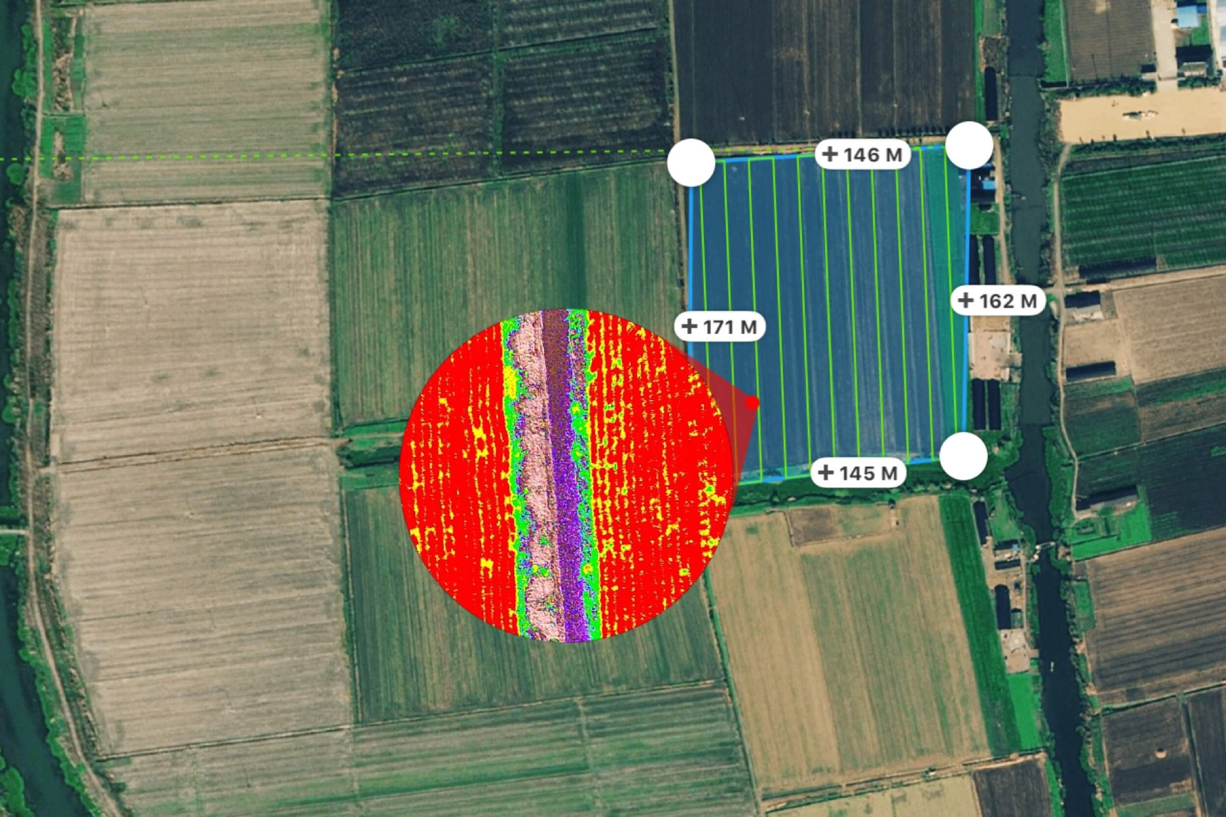
Multispectral Analysis
Unmanned aircraft, equipped with multispectral cameras, are successfully used in agriculture, forestry, and environmental conservation to efficiently and rapidly gather data about vegetation conditions, even over extensive areas.
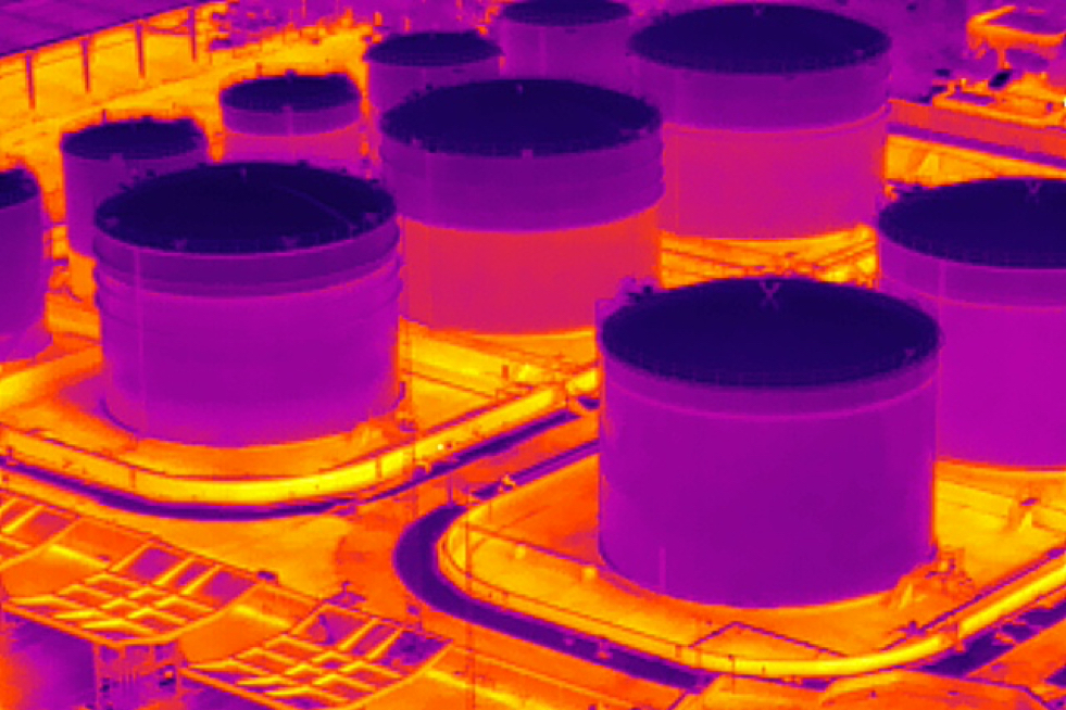
Thermography
Thermal sensing using drones is a very useful diagnostic and research technique. Unmanned aerial vehicles equipped with thermal sensors monitor the infrared radiation of objects or surfaces.