
Read More
Ask an Expert

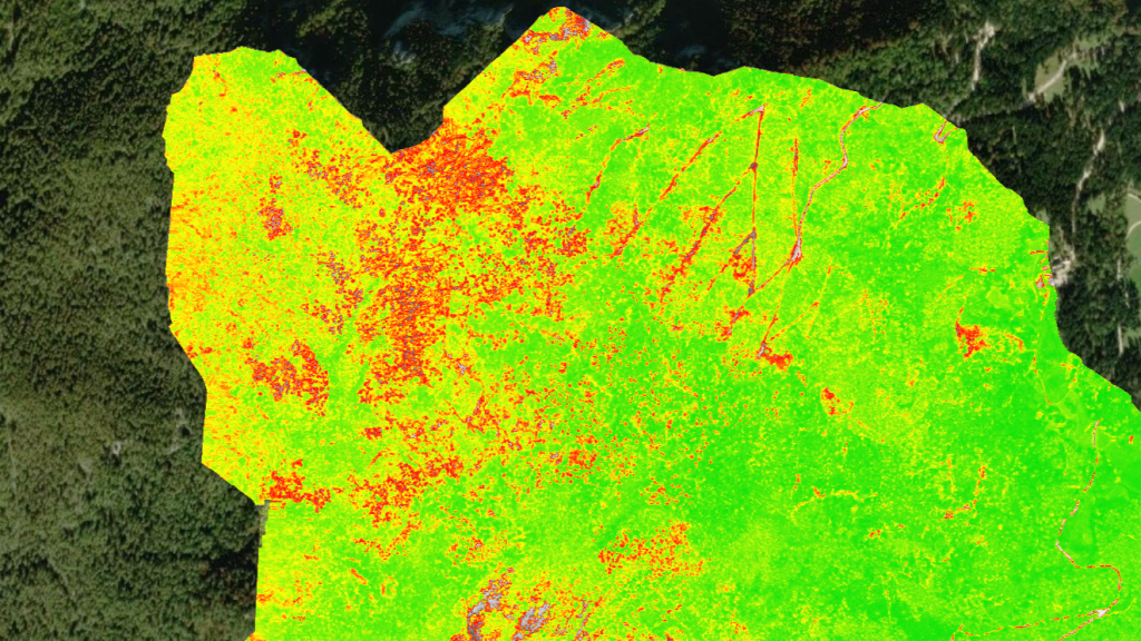
Multispectral drones detect light spectra that are invisible to the human eye. NDVI and other vegetation indices enable rapid, comprehensive, and repeatable analysis of crop, grassland, or forest conditions. Based on this data, we can identify areas of stress, disease, or nutrient deficiency. The results support decision-making in precision agriculture, which means lower costs, better yields, and sustainable land management.
NDVI and advanced vegetation indices
Thermography is often used in the maintenance and inspection of solar power plants. Thermographic cameras can detect the thermal radiation emitted by solar panels, and this can help detect various problems that could affect the efficiency and long-term operation of the solar power plant.
Detection of pests and diseases
Through timely analysis, we can locate focal points of pest attacks, such as bark beetles, and thus prevent the spread of damage. Multispectral data reveals irregularities in leaf structure and photosynthesis – even before visible signs of infection appear.

Contact Me!
David Hovnik, mag. inž. geod. geoinf.
Geodesy & Drone Inspections
+ 386 41 593 740
david@onedrone.si
Why multispectral drone analysis empowers modern precision agriculture
- Detects vegetation stress
- NDVI & spectral indices
- Pest hotspot mapping
- Data-driven decisions
At OneDrone, we offer drone-based agricultural diagnostics using NDVI and multispectral imaging to assess plant health and detect early threats. This enables smarter intervention, higher yields, and sustainable farming practices. Suitable for vineyards, crop fields, and forest management.
Related Resources
No related news found.